Garbyang Fm
Type Locality and Naming
Named after Garbyang village in Kali Valley, Pithoragarh district, Uttarakhand. [Original Publication: Shah, S.K., Sinha, A.K., 1974. Stratigraphy and tectonics of the Tethyan zone in a part of western Kumaon Himalaya. Himalayan Geology 14, 1-27.]
Synonyms: Heim and Gansser, 1939 “Garbyang Series”; Shah and Shina, 1974 “Garbyang Formation”
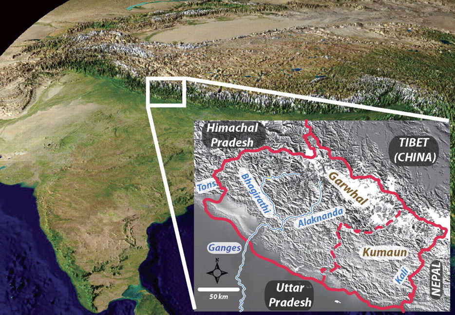
[Figure 1: Location of the Kumaun-Garhwal region (from Celerier et al., GSA Bull 2009)]
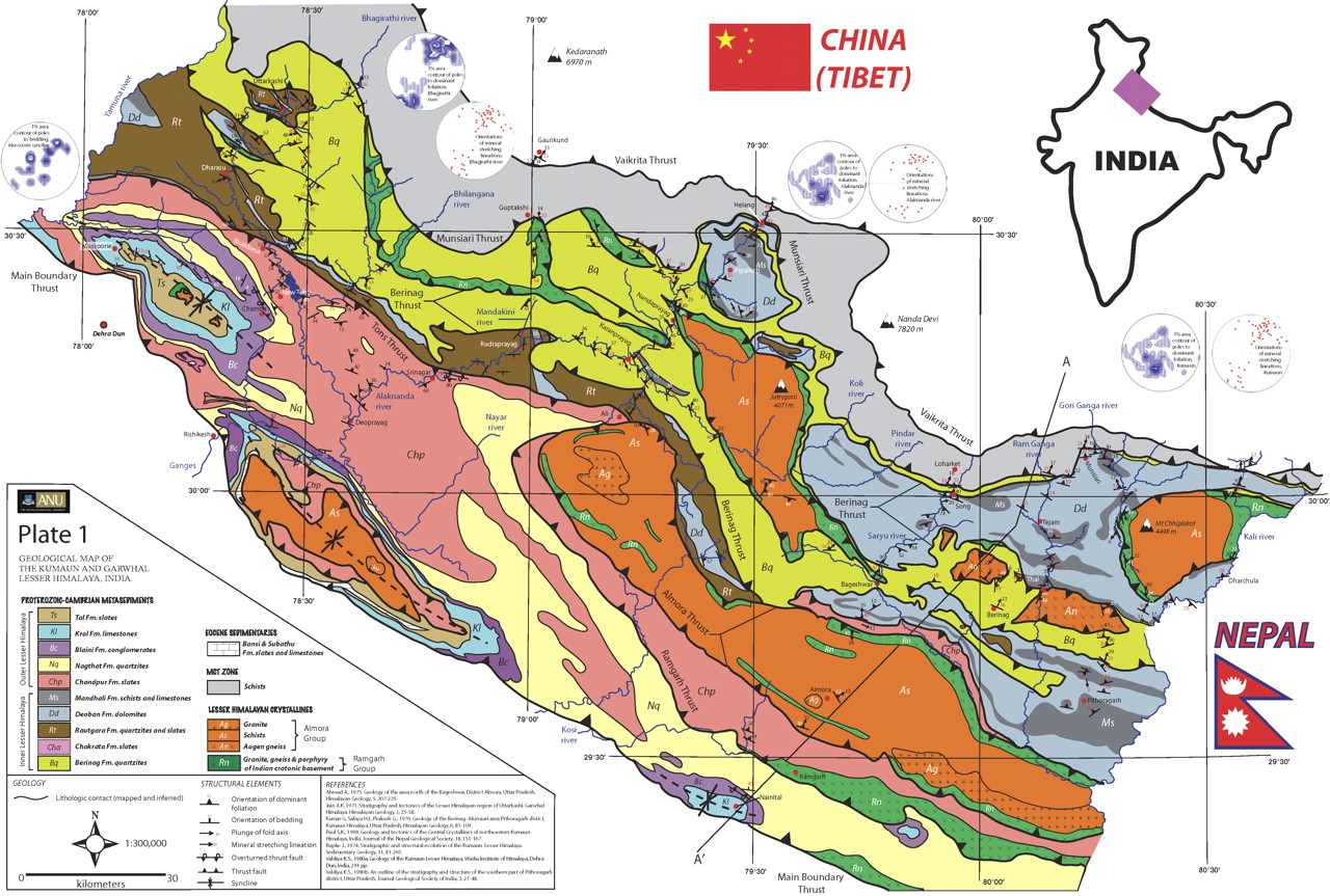
[Figure 2: Geologic map of the Kumaun-Garhwal region (from Celerier et al., GSA Bull 2009)]
Lithology and Thickness
Calcareous shale. Comprised of phyllite, limestone, shale succession. >3000m thick. Thickness increases towards SE direction.
Relationships and Distribution
Lower contact
Conformably overlies the Ralam Fm with a gradational contact.
Upper contact
Regional extent
Kumaun to Garhwal regions
GeoJSON
Fossils
Gastropods: Eccliopteris kushanensis; Crinoidal limestone; fragments of trilobite; Lingulids Brachiopods; Trace fossils are Scoyenia; Phycodes; Cruziana; Rusophycus; Isopodichnus; Gyrochorte; Scolicia; Lennea (Tandon and Bhatia, 1978); Raunultia (Kumar et al., 1987). Trilobites: Cherirurus mitis; ? Calymene sp.; Pareleloma sp. Gastropods: Raphistoma himalaicum; Liospira sp.; Ecculiomphalus kushanensis.
Age
Depositional setting
Not available.
Additional Information

